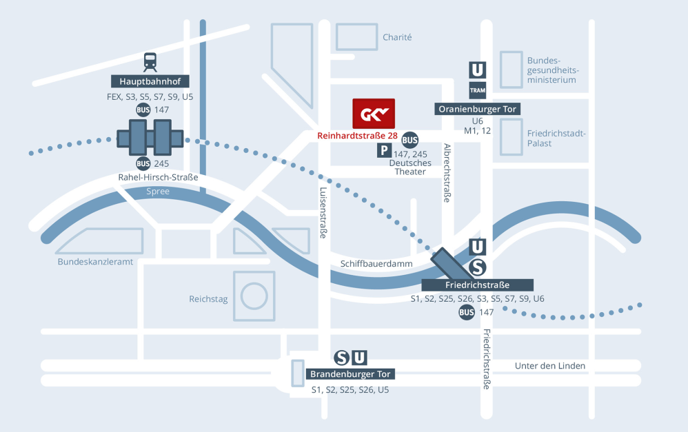
The closest long-distance station is the Main Station (Hauptbahnhof). Continue by S-Bahn (S 5, S 7, S 75; one stop on all lines) as far as Friedrichstrasse or take the bus 147 or 245 to Deutsches Theater.
Part of the city map of Berlin
Arriving by train
Arriving by car
From Berlin-Mitte:
Unter den Linden -> Friedrichstraße -> Reinhardtstraße or
Unter den Linden -> Luisenstraße -> Reinhardtstraße
Invalidenstraße -> Luisenstraße -> Reinhardtstraße
There is a public multi-storey car park in Reinhardtstraße 27a (Residenz am Deutschen Theater).
Arriving by air
The airport BER is connected to the local public transport network.
- Take Regionalbahn RE 8 towards Wittenberge oder RB 23 towards Golm, get off at Friedrichstraße (journey time approx. 35 min)
- Take the train DB FEX, get off at Berlin Main Station (Hauptbahnhof), take the bus 147 or 245 or on foot (journey time approx. 35 min)
- Take S-Bahn S9 towards Spandau, get off at Friedrichstraße (journey time approx. 50 min)